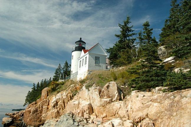
Bass Harbor light house, photo courtesy National Park Service
Overview
I’ve mentioned before that at an early stage in my career, I was very much a high mountain snob; but that when I began working on the geology of the Blue Ridge Mountains of North Carolina, I realized very early that there was also beauty in the eroded, lower Appalachian mountain system. So, for many years I looked forward to visiting Acadia National Park on and near the Maine coast. My wife Charlie and I finally visited Acadia National Park in September of 2004. We arrived after Labor Day very near the end of the tourist season, so it was not crowded and we were able to thoroughly enjoy our visit. The weather was cool and mostly clear. The autumn leaves were a bit past their peak but still quite spectacular.
Most of Acadia National Park is located on Mt. Desert Island, just off the coast of Maine. The Maine coast near Acadia is very rugged due to the fact that much of Maine, including Acadia National Park, is part of the complex and extensive Appalachian Mountain system. The mountains have been eroding down for several hundred million years, giving rise to the rounded nature of residual mountains, similar in many ways to the Piedmont Province of North and South Carolina. The above picture is of Jordan Pond, which was formed during the last glacial period.
Environmental Concerns
Global Climate Change The 4th National Climate Assessment, Chapter 18 summarizes climate change effects in the northeastern part of the United States saying that the states of Maine, New Hampshire, Vermont, New York, Connecticut, Massachusetts, Rhode Island, Pennsylvania, New Jersey, Pennsylvania, Delaware and Maryland, will continue to experience increasing temperatures, increasing rainfall and rainfall intensity, more severe storms like Superstorm Sandy in 2012 and more floods due to global climate change. (https://nca2018.globalchange.gov/chapter/18/) Acadia should expect to experience all of the above.
Sea level rise has intensified impacts in the Northeast through higher surges that extend farther inland, as demonstrated in New York City and parts of New Jersey in the aftermath of Superstorm Sandy in 2012. Because of its location in Maine, on the Atlantic coast, Acadia will likely see heightened storm surge, heavier rainfall, warming temperatures and invasion of non-native species from global climate change. Sea-level will rise, likely resulting in loss of or damage to the Park’s ecosystems (beaches, salt marshes, etc.), some roads and trails, including the Park’s historic carriage roads, and impacts to beach towns.
Air Quality From the National Park Service web site, “Acadia National Park, Maine, is downwind from large urban and industrial areas in the states to the south and west. Polluted air coming from these areas is trapped by the park’s steep slopes and high peaks…Acadia National Park receives some of the highest levels of pollution in the northeastern US. Air pollution can harm ecosystems, scenic vistas, and public health. This is one of the most important environmental issues facing the park.
Nitrogen and sulfur compounds deposited from the air may cause acidification of soils, lakes, ponds, and streams. Surface waters and vegetation on the park’s high peaks and steep slopes with shallow soils and resistant bedrock that is unable to buffer excess acids are particularly sensitive. Mercury is also elevated in aquatic and terrestrial ecosystems at Acadia. Ground-level ozone at Acadia sometimes exceeds standards set by the U.S. Environmental Protection Agency.
Human-caused haze frequently impairs scenic vistas at the park. Many of the same pollutants that ultimately fall out as nitrogen and sulfur deposition also contribute to…haze. Organic compounds, soot, and dust reduce visibility as well. Visibility effects (include) reduction of the average natural visual range from about 110 miles (without the effects of pollution) to about 90 miles because of pollution at the park; and reduction of the visual range from about 70 miles to below 50 miles on high pollution days.”
Visitor Impacts Even though Acadia is one of the smallest of the National Parks in size, it is one of the 10 most visited of the National Parks and is being subjected to many of the same visitor impacts as the highly visited parks. Most of Acadia’s visitors come from Memorial Day to Labor Day, only approximately 100 days of the year. As a result the sensitive sub-alpine nature of the park, coupled with high visitation rates are often the cause of significant vegetation and soil damage. Parking spaces near the most popular overlook areas, such as on the summit of Cadillac Mountain, highest point in the park, become congested such that no parking can be found during peak visitation times. The relatively small number of motorized, trafficked roads are frequently are very congested during the high peak visitation period. Acadia is already employing shuttle systems to alleviate traffic problems. Camping is limited in Acadia National Park as it manages only four campgrounds; two on Mt. Desert Island, one on the Schoodic Peninsula and one very primitive campground only accessible by boat, on the Isle de Haut; numerous other privately owned campgrounds, motels and hotels are often also available. Acadia also has an extensive network of trails and non-motorized carriage roads, but even these are often very crowded during the high peak visitation period. Additionally, Acadia visitors frequently alter, destroy, or construct false cairns (pyramid shaped piles of rocks built by trail crews to mark trails and guide hikers).
Water Quality Jordan Pond is the largest and one of the clearest and most pristine of lakes and ponds in Acadia. The National Park Service has been monitoring the water quality of Acadia’s streams, lakes and pones. In Jordan Pond, water clarity has been declining since the mid-1990s. It has been suggested that this decline in water clarity in Jordan Pond could be due to a slight reduction in air pollution, which in turn could result in the water becoming less acidic, and in turn could result in more organic matter being present in the water.
Adjacent Development From a U. S. Geological Survey report: “In this study, we examined habitat fragmentation consequences owing to a planned 1,295 hectare development by Winter Harbor Holding Company adjacent to the Schoodic District of Acadia National Park, Maine. Specifically, we examined the effects of development on (a) core natural habitat area (a cross-habitat indicator of fragmentation), (b) the suitability of habitat for bobcat, fisher, mink, and moose, and (c) the movement of these four species between Acadia National Park and other nearby protected areas (species specific indicators of fragmentation). Our intention was to assist Acadia staff in forecasting both the general and specific effects of development on natural habitat area, habitat suitability, and animal movement, which would allow them to develop suitable management alternatives.” (https://pubs.er.usgs.gov/publication/sir20125149)
Invasive Species About one-third of Acadia’s flora is made up of invasive species, some of which are very dangerous; there are also non-native animal species that live in Acadia. Most of these invasive species were brought by humans, either deliberately or accidentally.
To the Reader Most of my sources were web sites which I indicate by their address at the end of the quoted material or my summary thereof. All references which state only “NPS” with no web address refer to the web address for this park: https://www.nps.gov/acad/index.htm. This is where 90% of all material for this report was found, and this is where you should first look for additional material. Warning: This web site is highly complex and it is often difficult find additional material.
